


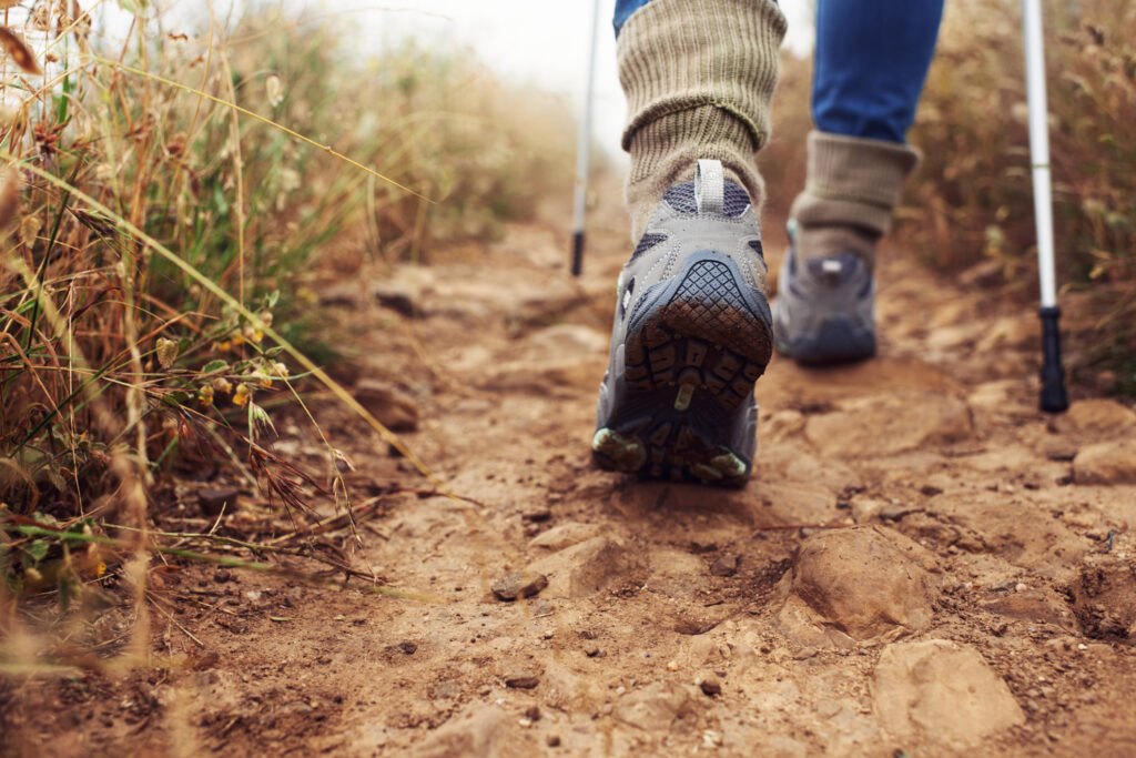
A hike is an invigorating way to exercise and get out-and-about in the Land of Enchantment. It doesn’t take much — a pair of shoes, a hat, a water bottle, and the desire to see nature on its own terms. Here in the beautiful Mora Valley you’ll find many opportunities to take long walks at your own pace to see big views among the trees in the Carson National Forest and beyond. While there are a few easy options, most of these trails are suited for intermediate to serious hikers. As with any hike, do your homework and prepare accordingly. New Mexico weather changes drastically and often so plan ahead and never put yourself in a dangerous situation.
Most of these trails can be found on AllTrails.com with GPS coordinates, descriptions, photos and other info. Click on a link below to jump to that trail.
- Turquoise Mine Trail
- Agua Sarca Trail #16
- Fort Union National Monument
- Fort Union Overlook
- West Fork Angostura Trail
- Angostura Trail 493
- The Knob Loop
- Middle Fork, North Fork and Horseshoe Lake
- Cordova Trail #17
- Indian Lake Trail #19C
- Serpent Lake Trail
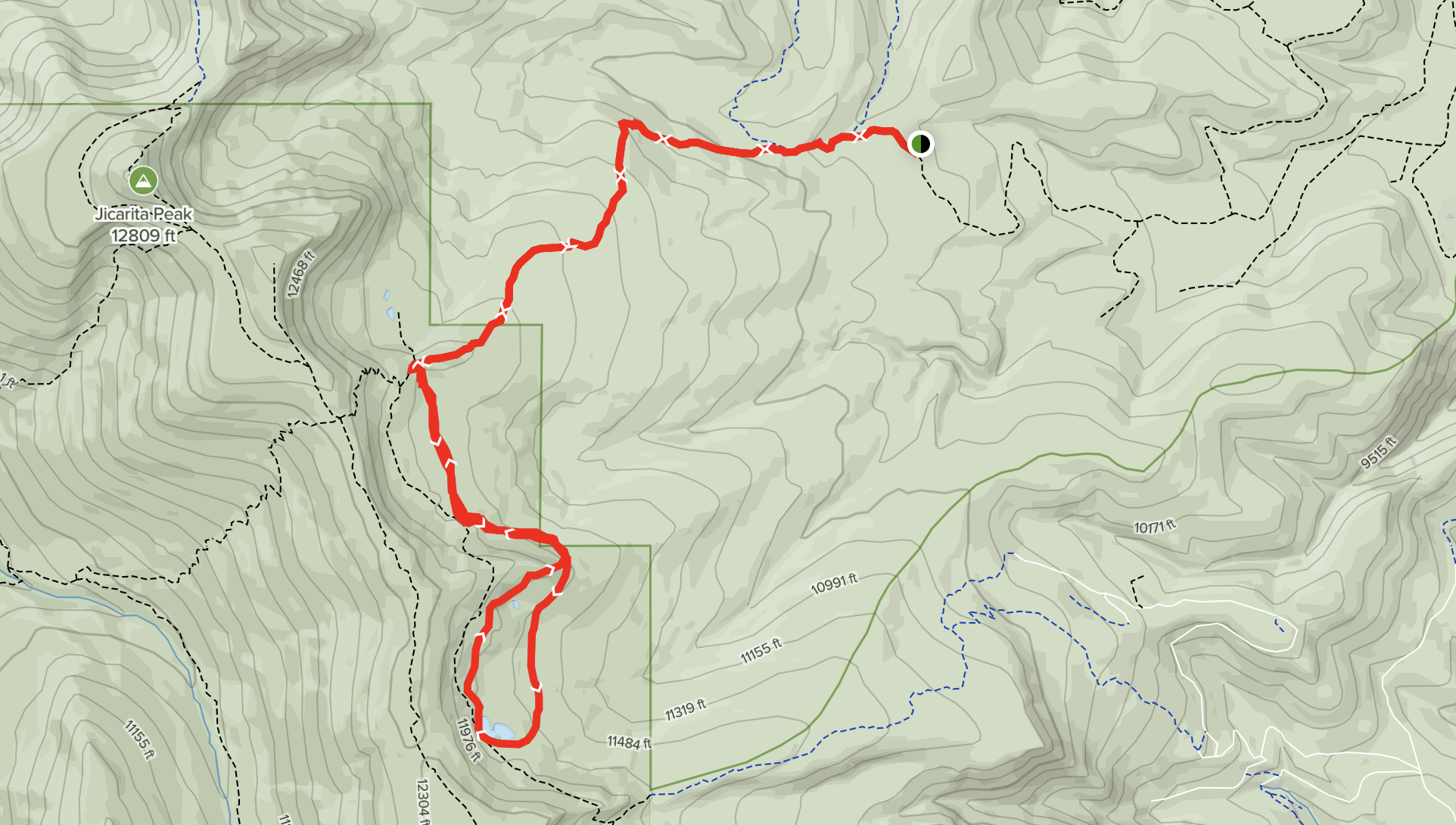
- Jicarita Peak
- Gallegos Peak via Flechado Canyon
- Gallegos Canyon to Flechado Canyon
- Horseshoe Lake
- Coyote Creek State Park – Eusebio Romero Trail
Photo by Janice Alsum – Buena Vista, Colorado; AllTrails.com
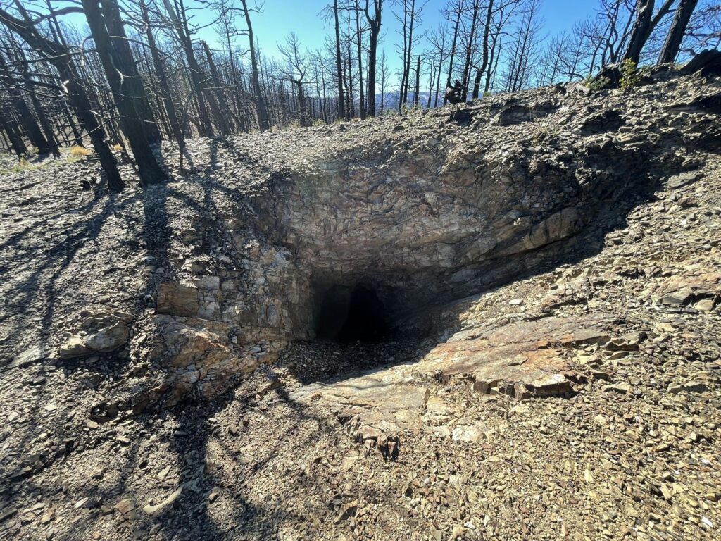
Turquoise Mine Trail
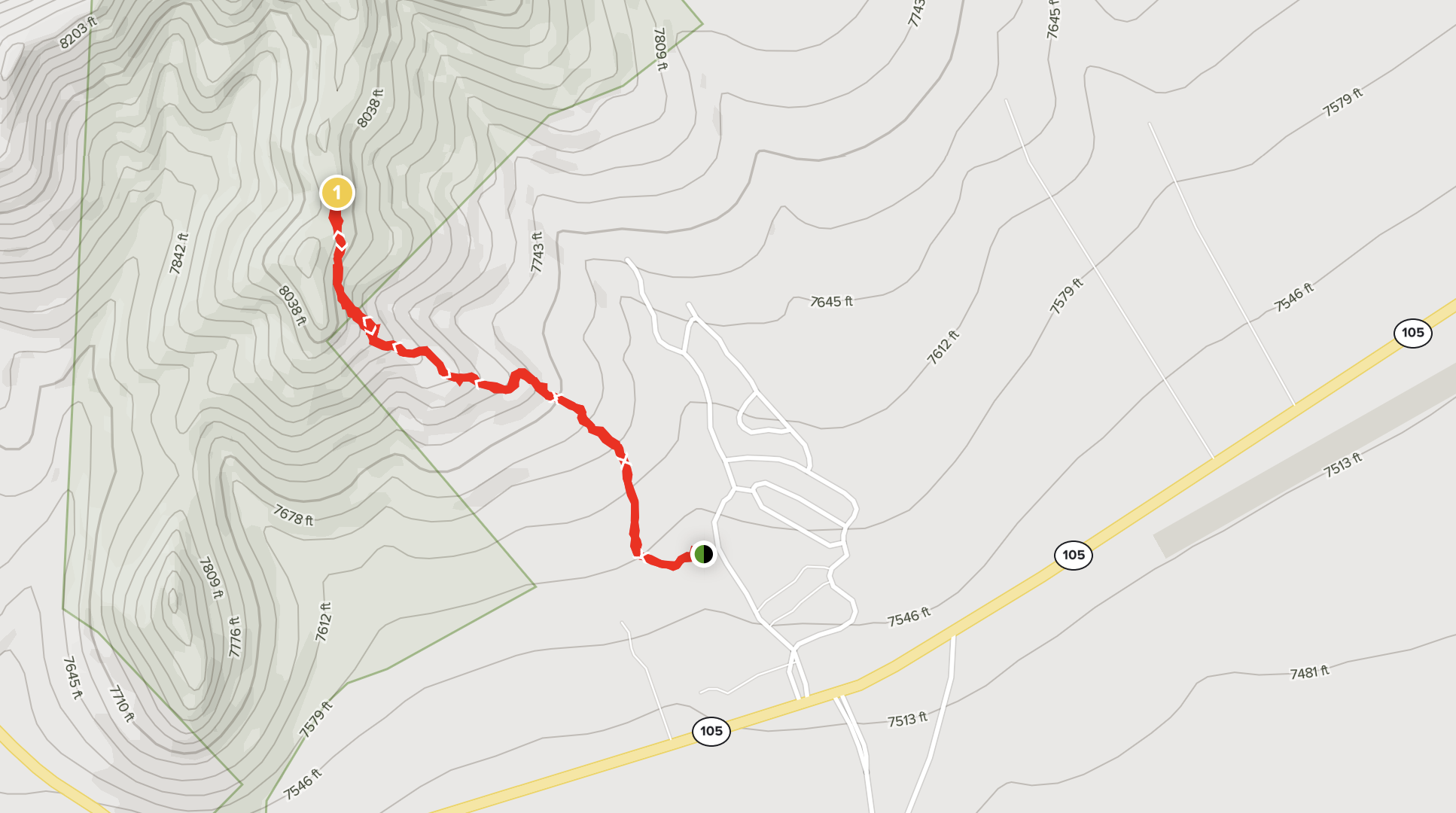
NOTE: This trail was seriously affected by the CCHP Fire of 2022.
Distance / Type: 1.7 Mile out and back
Trail rating: Moderate
Elevation Gain: 505’
Description: This moderately challenging trail near Rociada, New Mexico takes an average of 1 h 1 min to complete. This trail is great for hiking and running, and it’s unlikely you’ll encounter many other people while exploring. The trailhead is located inside the Penderies RV Park between the 28th and 29th RV slot so park at the entrance and walk in. You can also obtain a map in the RV park office. Some sections are quite steep but not dangerous. There is an abandoned turquoise mine at the top of the trail and you can sift though the discarded chaff to find small pieces of turquoise colored rock. Use caution not to fall in the mind or down the hill. A not-very-well marked trail continues up the ridge for the more adventurous hiker.
Trail tips: Walking sticks may be useful. Bring lots of water and sunscreen. Very few bugs. There is a geocache in the area.
Photo by Sofiya Hlynchuk – Rio Rancho, NM; AllTrails.com
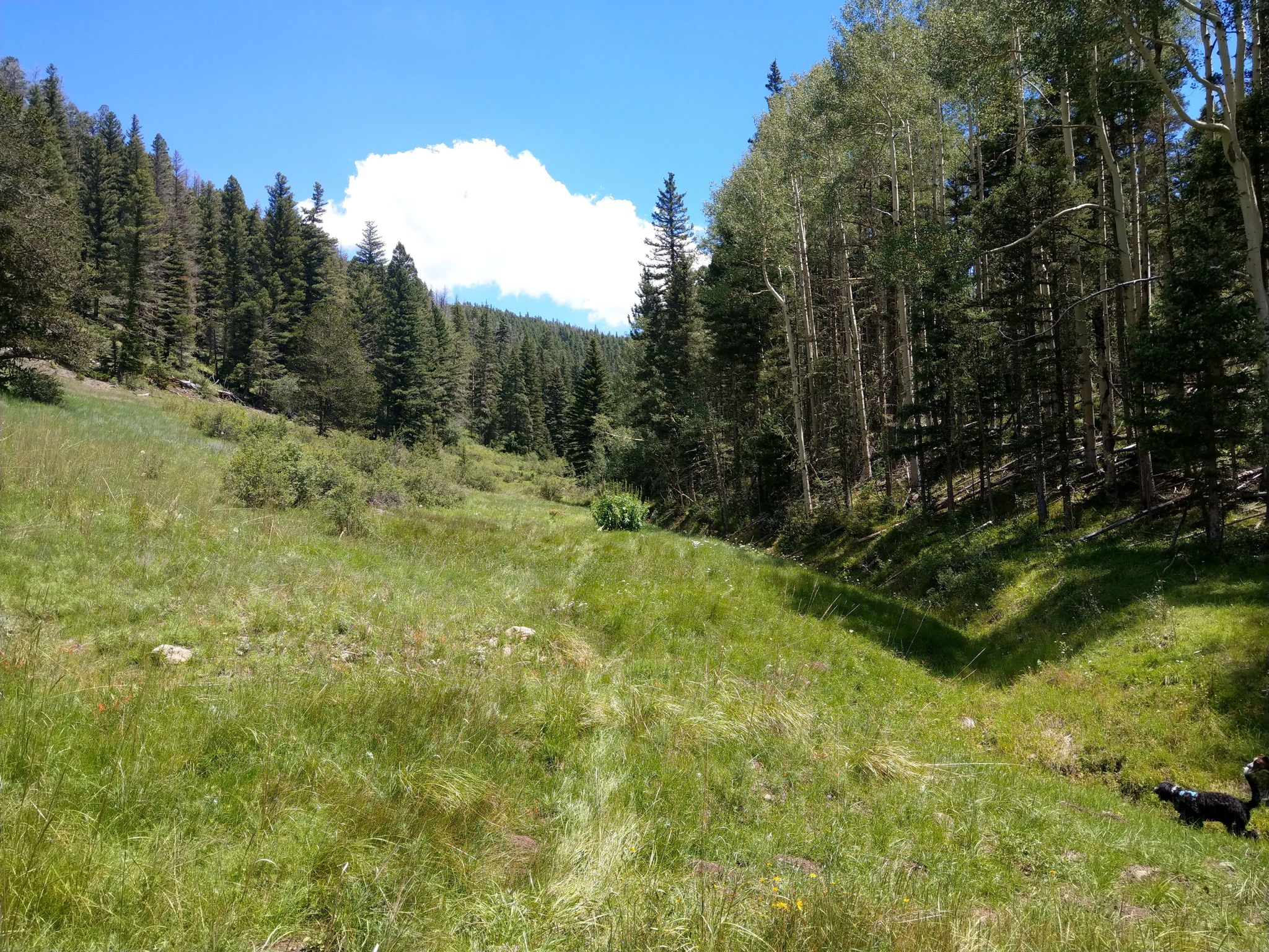
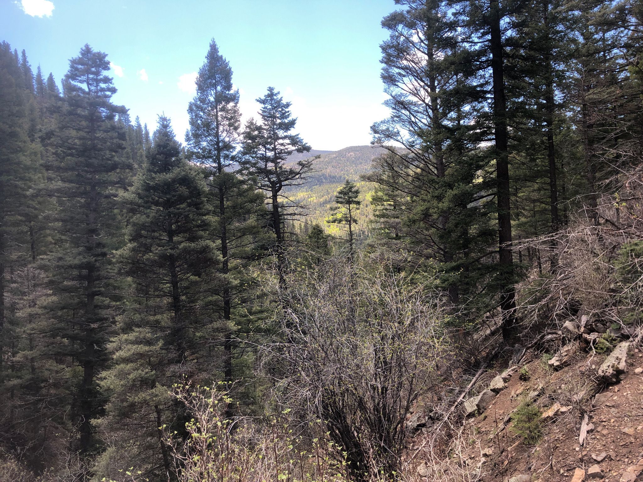
Agua Sarca Trail #16
Distance / Type: 5.7 Mile out and back
Trail rating: Moderate
Elevation Gain: 836’
Description: This moderately challenging trail near Vadito, New Mexico, is half meadow and half forest. It generally takes an average of 2 h 30 min to complete. This trail is great for hiking, horseback riding, and mountain biking, and it’s unlikely you’ll encounter many other people while exploring but you may encounter wildlife.
Trail tips: Walking sticks may be useful. Bring lots of water, sunscreen, bug spray, bear spray .There are two geocaches on this trail.
Photo by Rolando Flores – Denver, CO; AllTrails.com
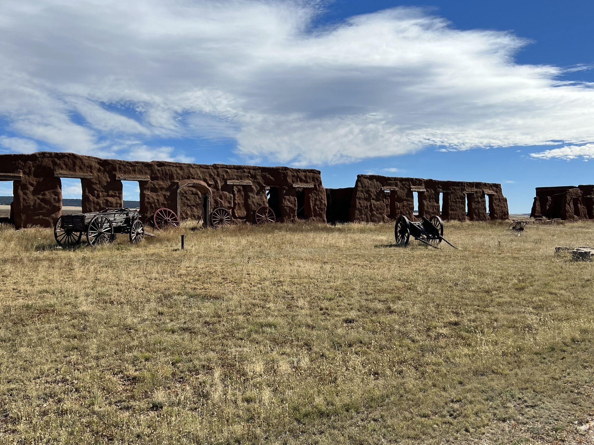
Fort Union Nat’l Monument
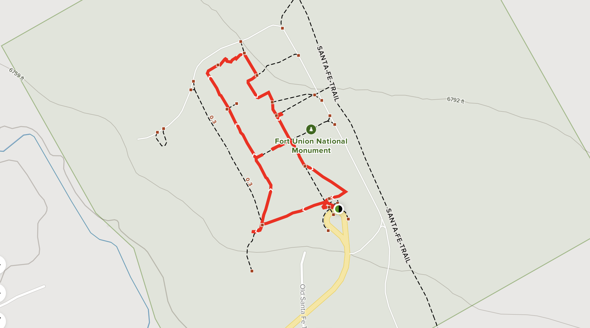
Distance / Type: 1.4 Mile loop
Trail rating: Easy
Elevation Gain: 22’
Description: This flat trail near Watrous, New Mexico is more of a walking tour than a trail as it is located in the Fort Union National Monument and meanders through the historic ruins of the old fort. Generally considered an easy route, it takes an average of 25 min to complete on your own, or 90 minutes with a guide. This is a popular trail for hiking and walking, but you can still enjoy some solitude during quieter times of day. The trail is open year-round and is beautiful to visit anytime. Dogs are welcome and may be off-leash in some areas.
Trail tips: Bring lots of water, hats and sunscreen – there is NO SHADE. Highly recommend the guided tour. There is a geocache in the park office.
Photo by David Y. – San Francisco, CA; AllTrails.com
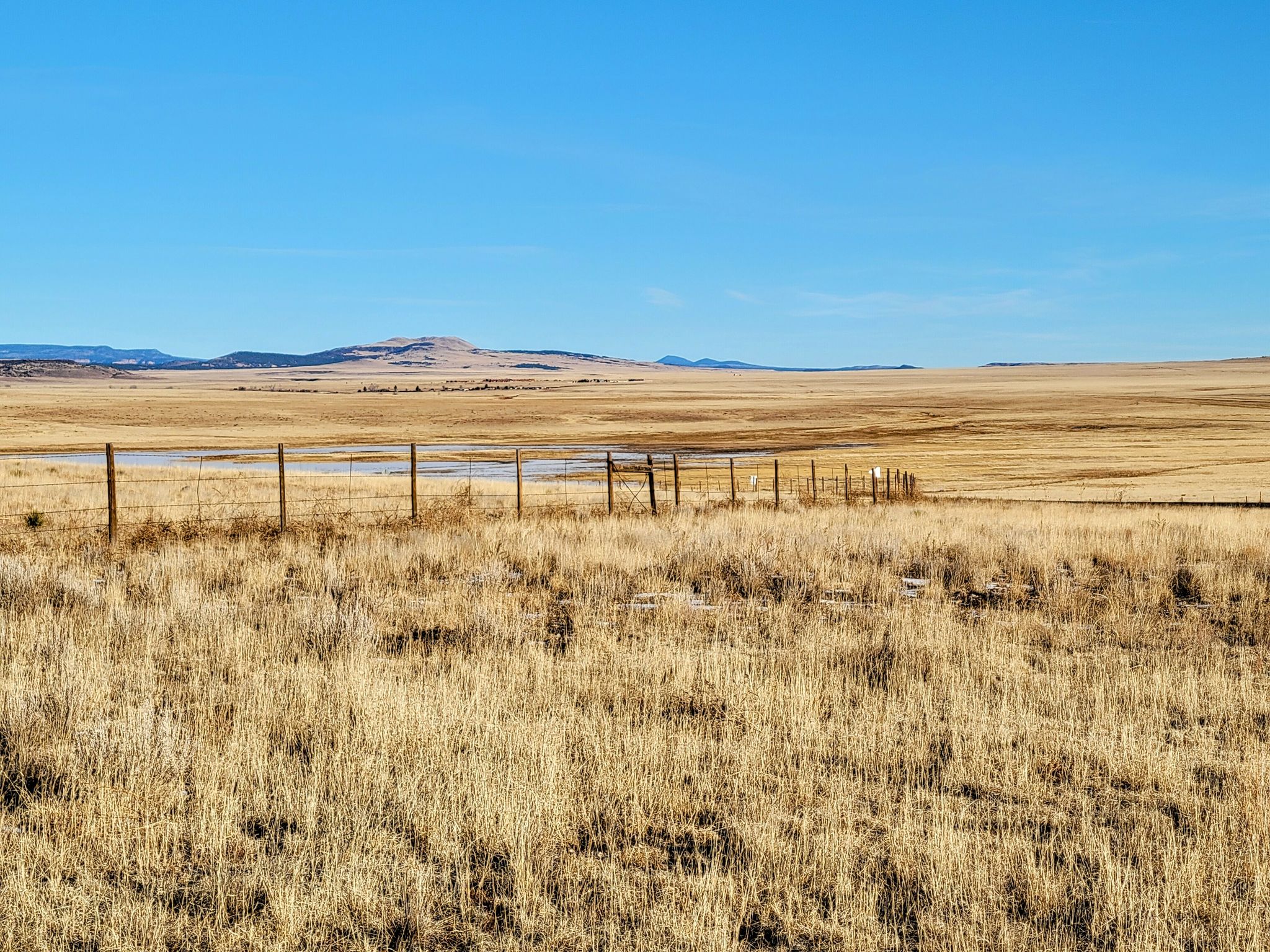
Fort Union Overlook
Distance / Type: .6 Mile out and back
Trail rating: Easy
Elevation Gain: 3% or less
Description: This .6-mile roadside trail near Watrous, New Mexico is a companion to the Fort Monument Trail and leads visitors to some informational panels and a distant view of Fort Union nestled in the high plains beneath the mountains. It is an easy route and generally takes 12 minutes to complete. The trail is open year-round and is beautiful to visit anytime.
Trail tips: Bring lots of water, hats and sunscreen – there is NO SHADE.
Photo by Katy Moore – Santa Fe, NM; AllTrails.com
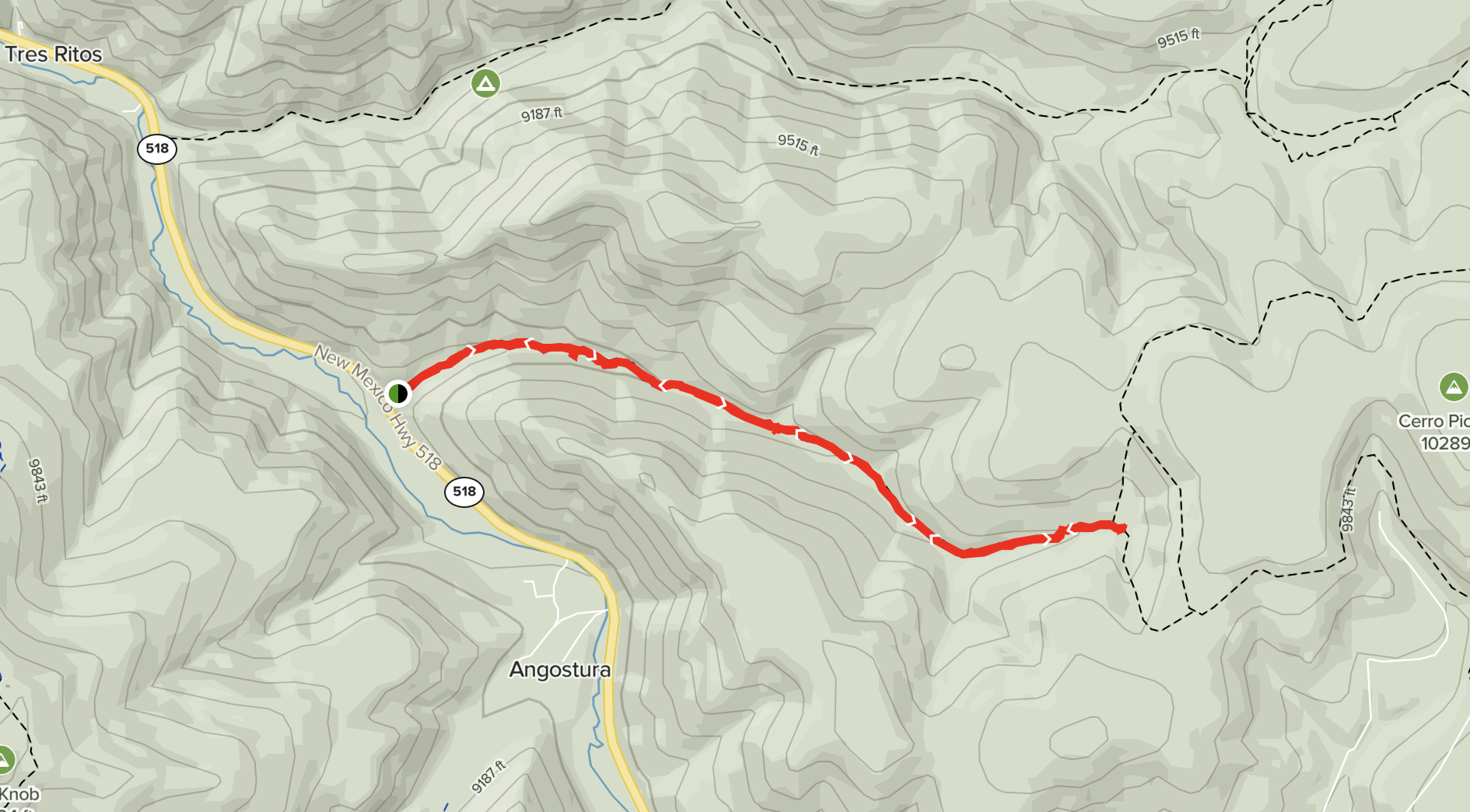
West Fork Angostura Trail
Distance / Type: 12 Mile out and back
Trail rating: Moderate
Elevation Gain: 2,870’
Description: Enjoy this 12.0-mile out-and-back trail near Angostura, New Mexico. Generally considered a moderately challenging route, it takes an average of 6 h 27 min to complete. The trail is somewhat rocky and leads to a high meadow with small streams. This is a popular trail for hiking and walking, but you can still enjoy some solitude during quieter times of day. The best times to visit this trail are March through October. Dogs are welcome, but must be on a leash.
Trail tips: Walking sticks may be useful. Bring lots of water, bear spray and other essentials.There are two geocaches on this trail.
Photo by Katy Moore – Santa Fe, NM; AllTrails.com
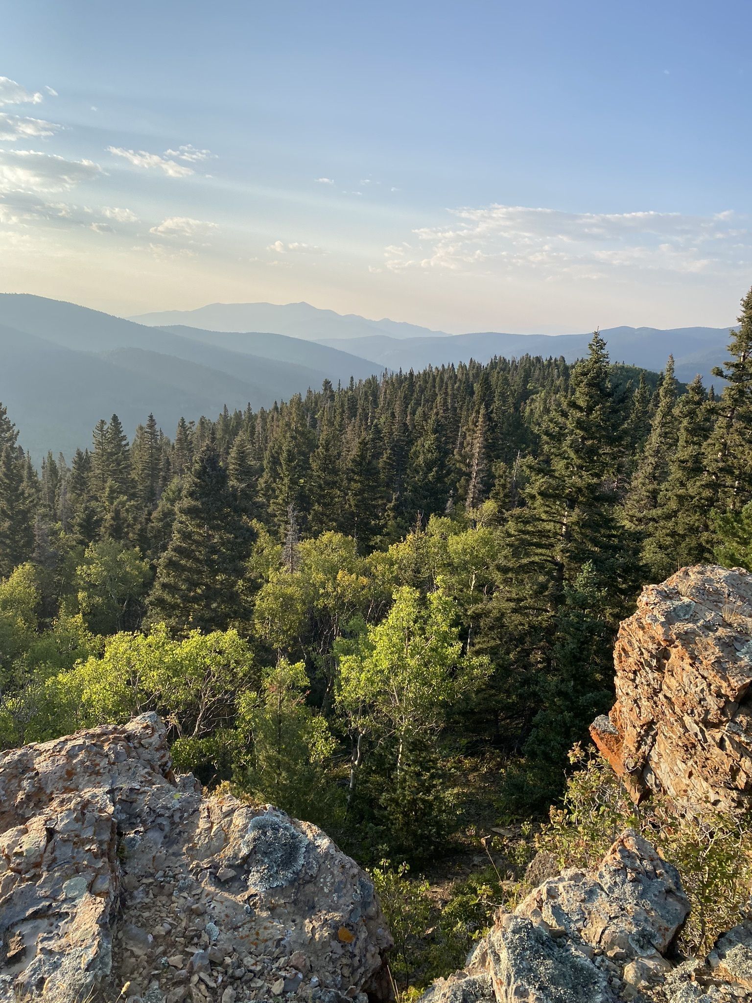
Angostura Trail #493
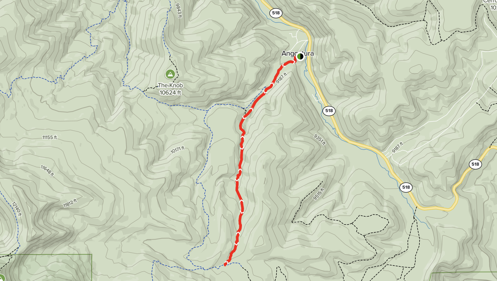
Distance / Type: 7.2 Mile out and back
Trail rating: Moderate
Elevation Gain: 1,450’
Description: Try this 7.2-mile out-and-back trail near Angostura, New Mexico takes an average of 3 h 34 min to complete. Park off the road and walk on the road past some cabins, over a stream and through the gate to the trailhead, approx. 0.9 miles. The trail is rocky in places and there are some water crossings. The best times to visit this trail are March through October.
Trail tips: Walking sticks may be useful. Bring lots of water, bear spray and other essentials.
Photo by Kane S – Bethesda, MD; AllTrails.com
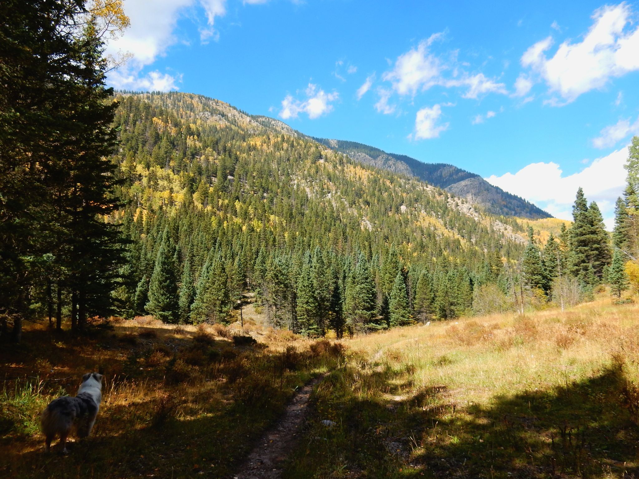
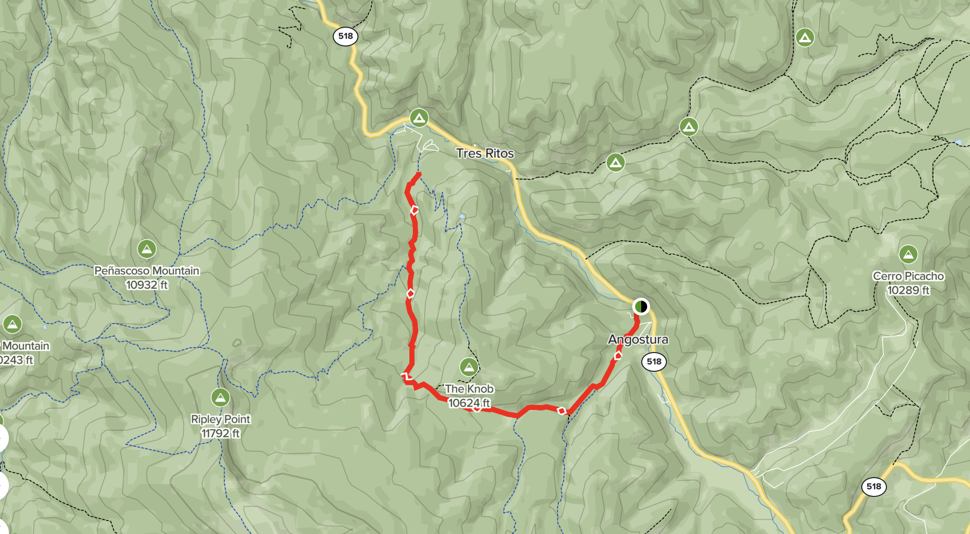
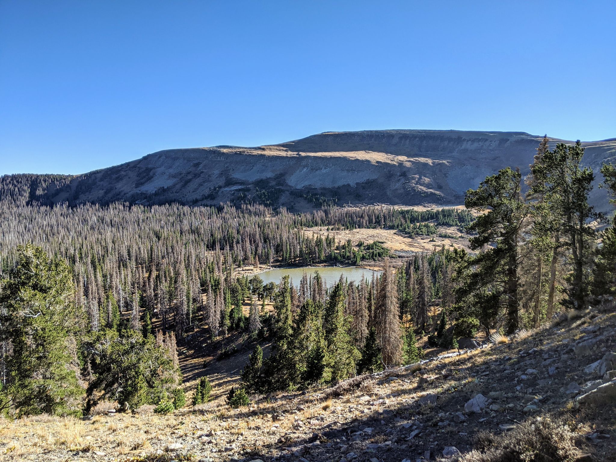
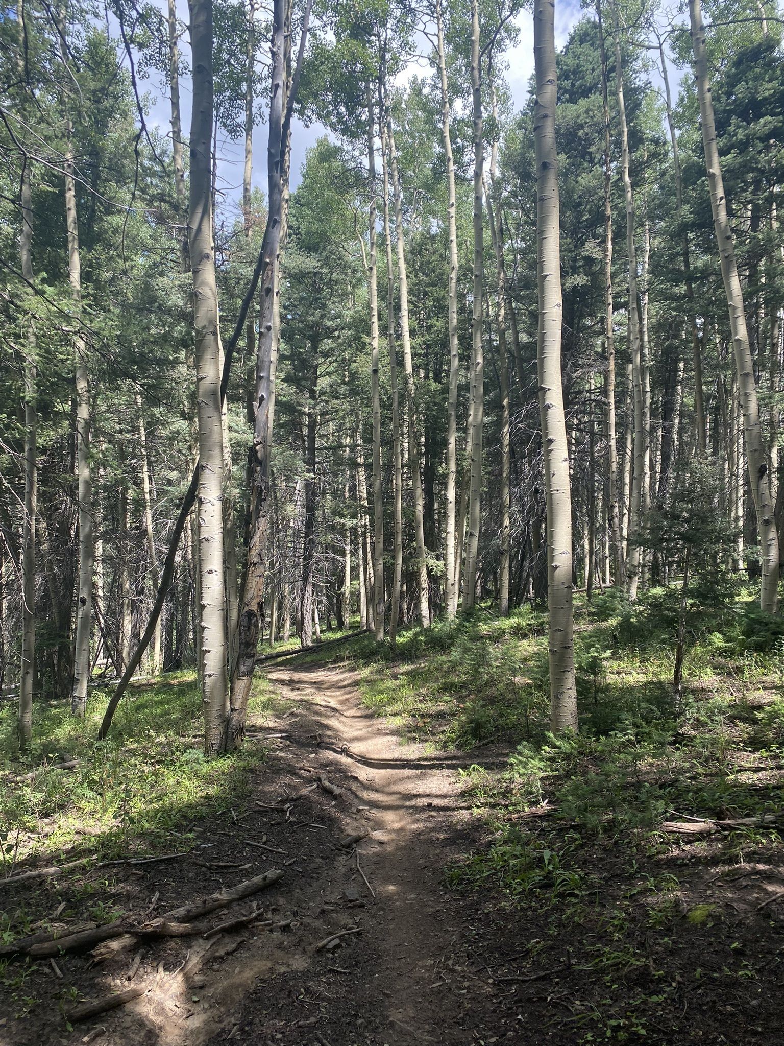
The Knob Loop
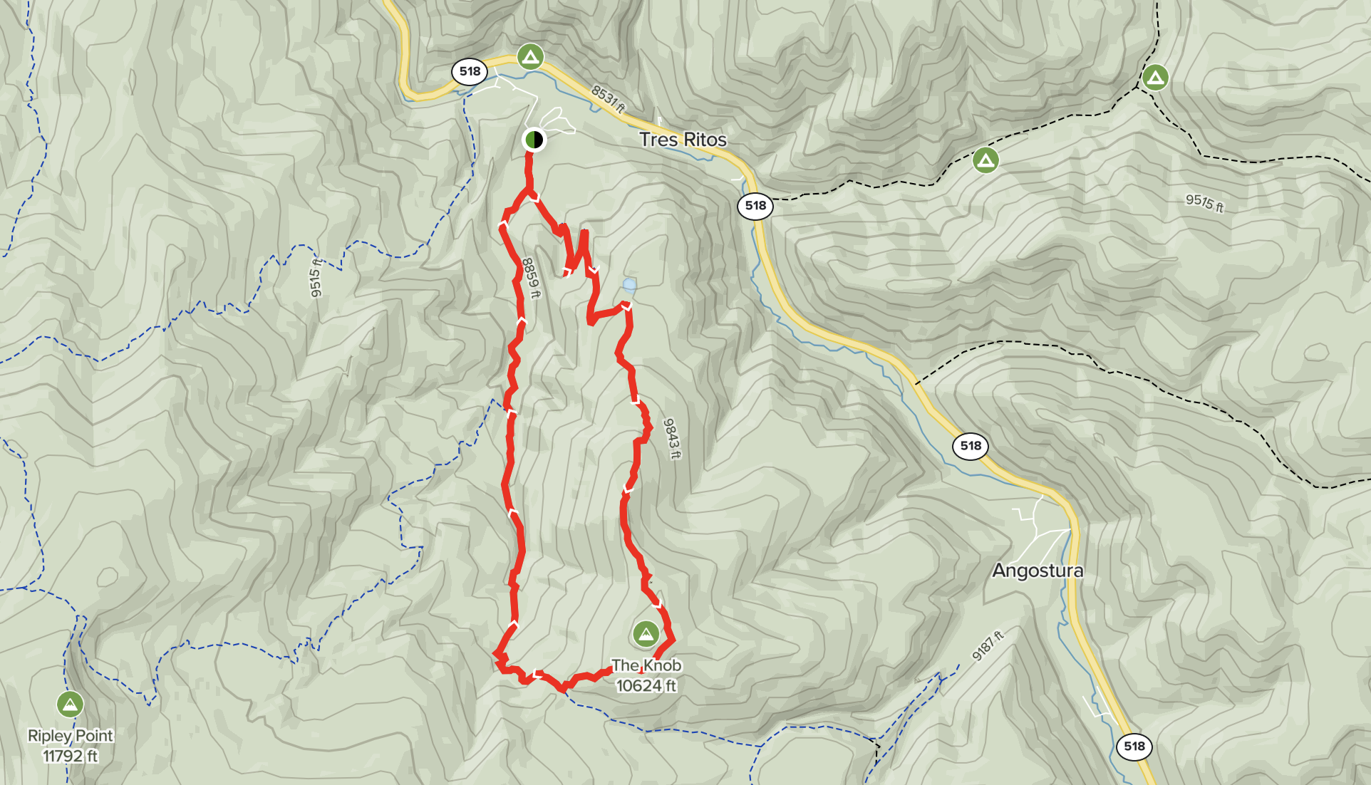
Distance / Type: 7.3 Mile loop
Trail rating: Hard
Elevation Gain: 1,998’
Description: This 7.3-mile loop trail near Vadito, New Mexico is generally considered a challenging route, and takes an average of 4 h 11 min to complete. The trail condition may be compromised due to the fire and floods of 2022. It features stream crossings, vast meadows, beautiful trees, numerous mountain views and a little lake/pond. The ascent and descent are very steep regardless of direction. This trail is great for hiking and running, and it’s unlikely you’ll encounter many other people while exploring.
Trail tips: Walking sticks may be useful. Bring lots of water, bear spray and other essentials.
Photo by Benjamin Gibson – Albuquerque, NM; AllTrails.com
Middle Fork, North Fork & Horseshoe Lake
NOTE: This trail may be seriously affected or closed due to the CCHP fire of 2022.
Distance / Type: 14.7 Mile loop
Trail rating: Hard
Elevation Gain: 3,480’
Description: This 14.7-mile loop trail near Cleveland, New Mexico is generally considered a challenging route, and takes an average of 7 h 52 min to complete. This trail is beautiful but remote with access starting at Walker Flats. This trail is great for backpacking and hiking, and it’s unlikely you’ll encounter many other people while exploring. The best times to visit this trail are June through October.
Trail tips: Walking sticks may be useful. Bring lots of water, bear spray and other essentials.
Photo by Emily Frank – Austin, TX; AllTrails.com
Cordova Trail #17
Distance / Type: 7.6 Mile out and back
Trail rating: Hard
Elevation Gain: 2,332’
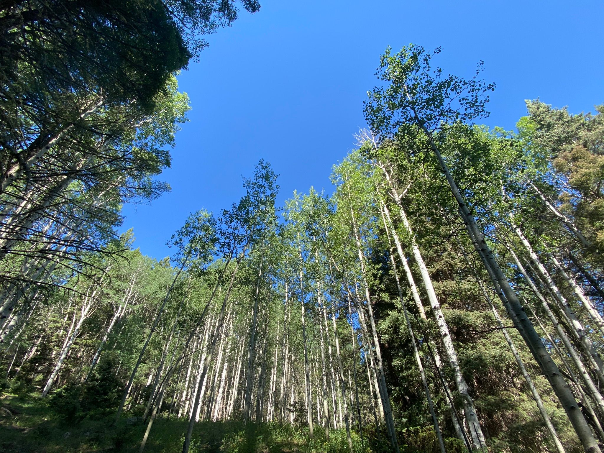
Description: This 7.6-mile out-and-back trail near Vadito, New Mexico starts steep uphill through aspen and pine forest then tapers off as it heads toward a small meadow surrounded by towering aspens. Spectacular especially in October when the leaves are changing. Generally considered a challenging route, it takes an average of 4 h 38 min to complete. This trail is great for camping, hiking, and snowshoeing, and it’s unlikely you’ll encounter many other people while exploring.
Trail tips: Walking sticks may be useful. Bring lots of water, bear spray and other essentials.
Photo by Sterling Rohde – San Antonio, TX; AllTrails.com
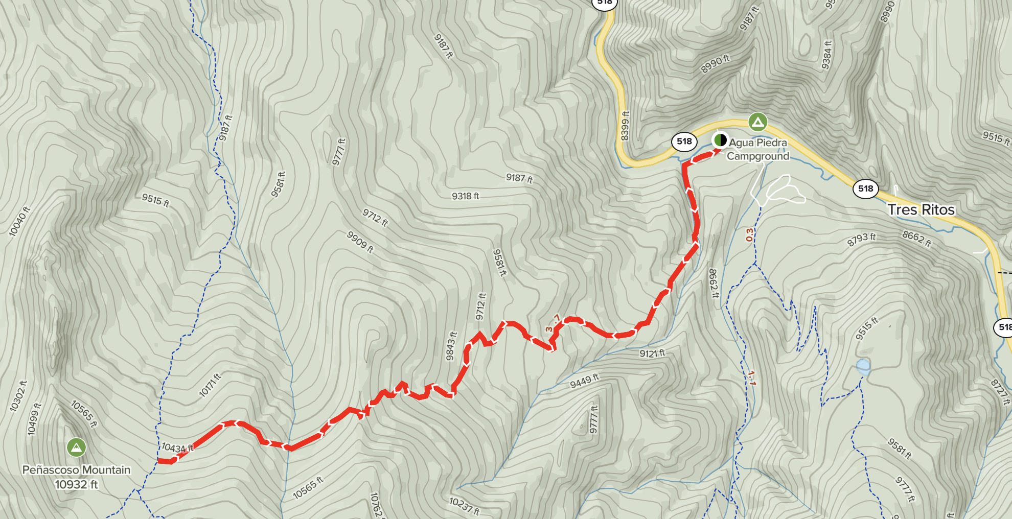
Indian Lake Trail #19C
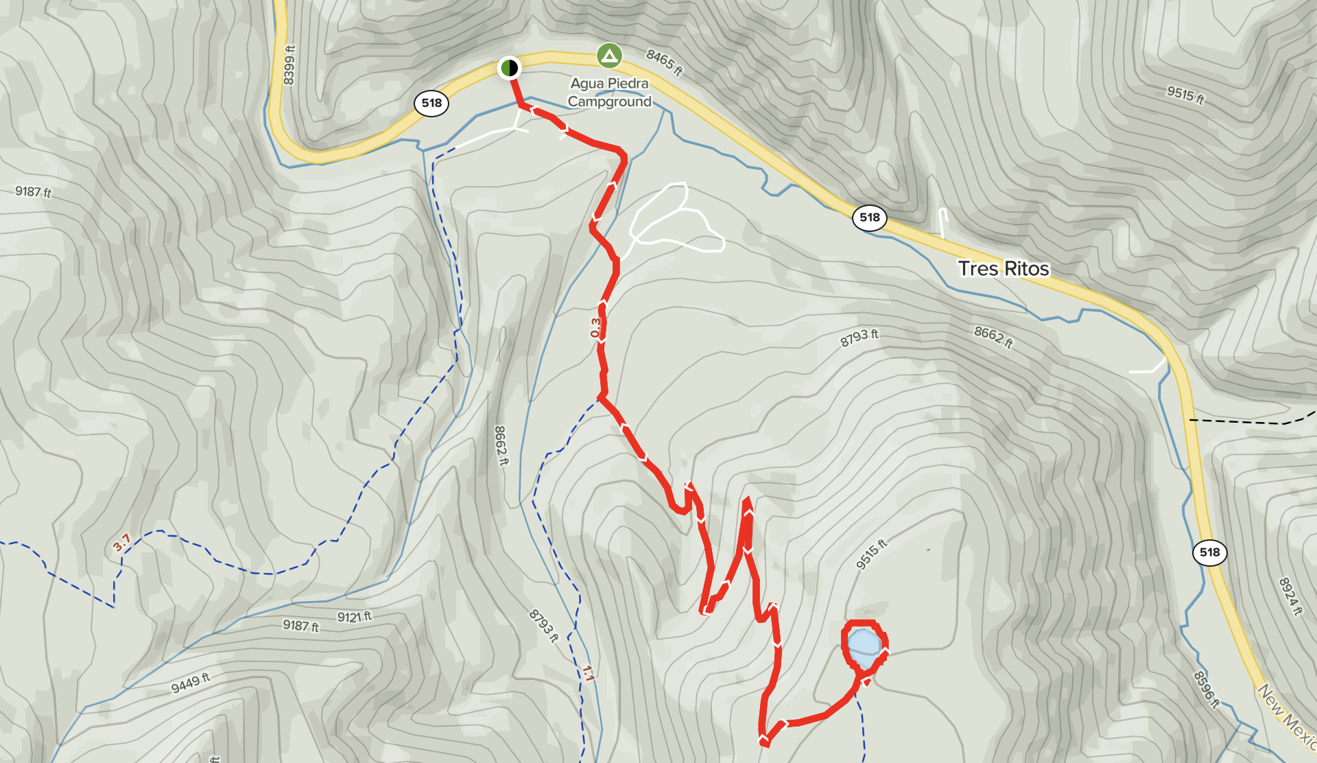
Distance / Type: 4.8 Mile out and back
Trail rating: Moderate
Elevation Gain: 1,141’
Description: This 4.8-mile out-and-back trail near Vadito, New Mexico is generally considered a moderately challenging route, and takes an average of 2 h 35 min to complete. It may be closed in winter months. Park at the bottom of the Agua Piedra campground to access the trailhead. The trail is not well marked so it is advised to use AllTrailsPro. This trail is great for camping, hiking, and running, and it’s unlikely you’ll encounter many other people while exploring.
Trail tips: Walking sticks may be useful. Bring lots of water, bear spray and other essentials. Several geocaches are reported to be on this trail but not confirmed.
Photo by Shawn Korte – Phoenix, AZ; AllTrails.com
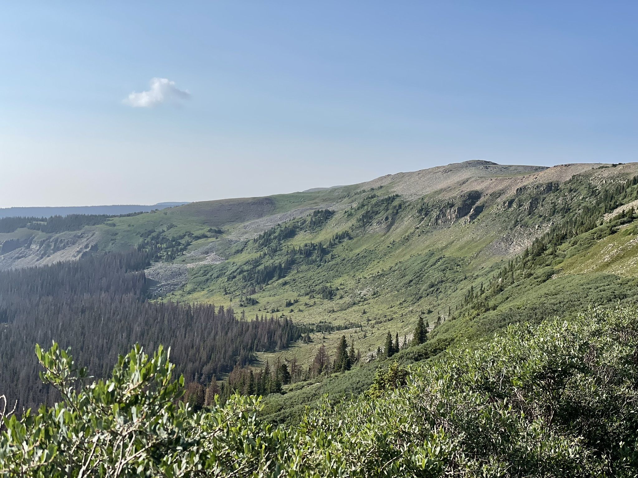
Serpent Lake Trail
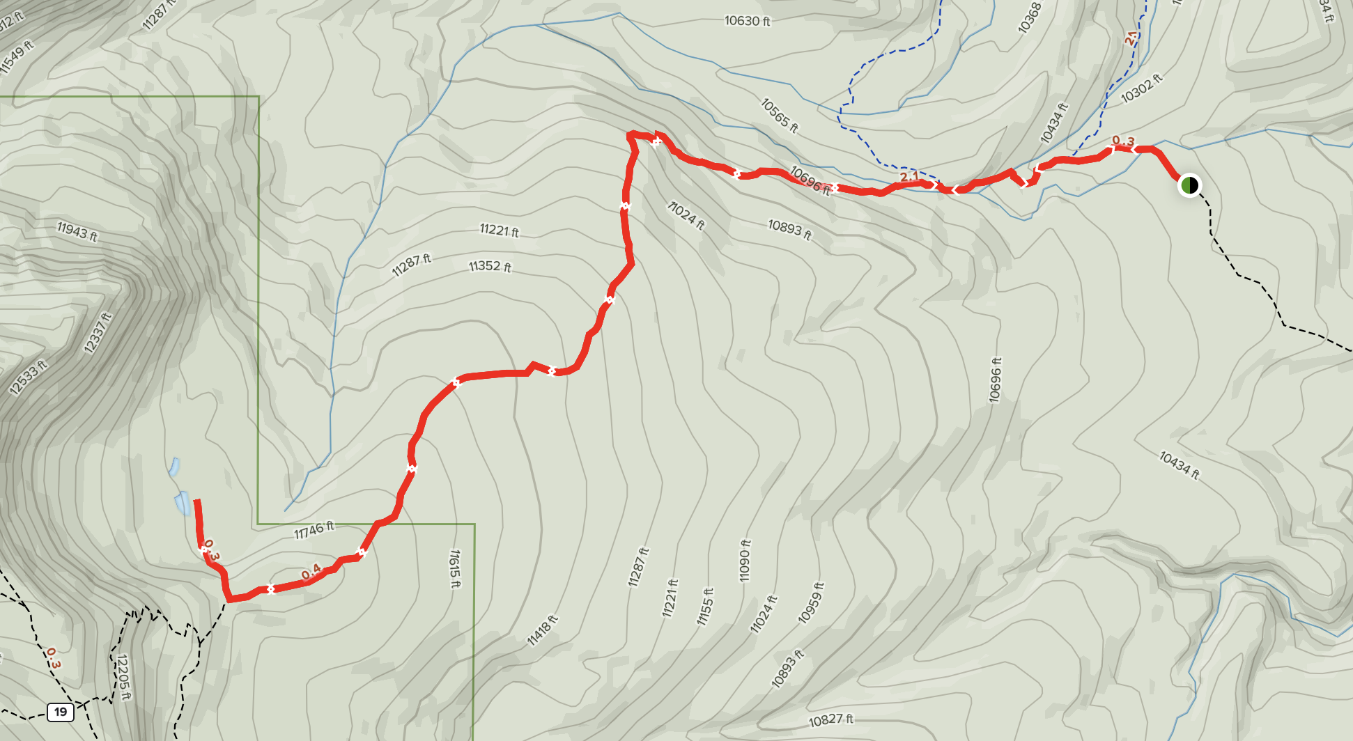
Distance / Type: 6.9 Mile out and back
Trail rating: Hard
Elevation Gain: 1,624’
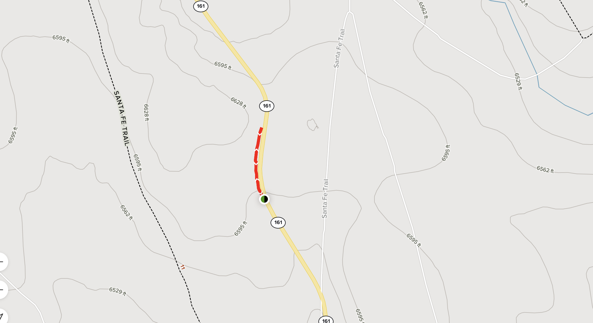
Description: This 6.9-mile out-and-back trail near Angostura, New Mexico is generally considered a challenging route, it takes an average of 3 h 41 min to complete. The trailhead is located 4 miles on forest road 161. The trail follows a horse pack trail up to the lake and can be rocky at times. Traversing the switchbacks that continue past the lake trail junction will reward you with 180 degree views of mountains, and a birds-eye-view of the Serpent lake basin. The 4 mile forest ride is in very good condition. You may encounter other hikers and horseback riders.
Trail tips: Walking sticks may be useful. Bring lots of water, bear spray and other essentials. A geocache is reportedly located near the trailhead.
Photo by BJ Allen – Estes Park, CO; AllTrails.com
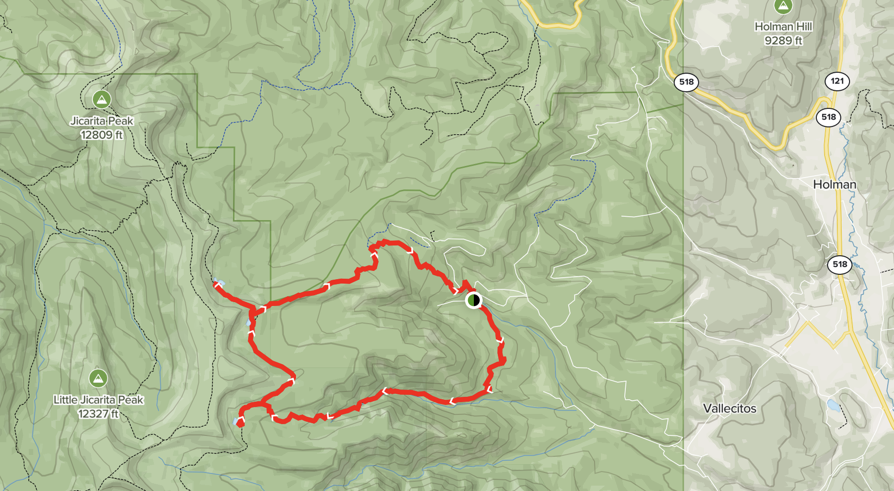
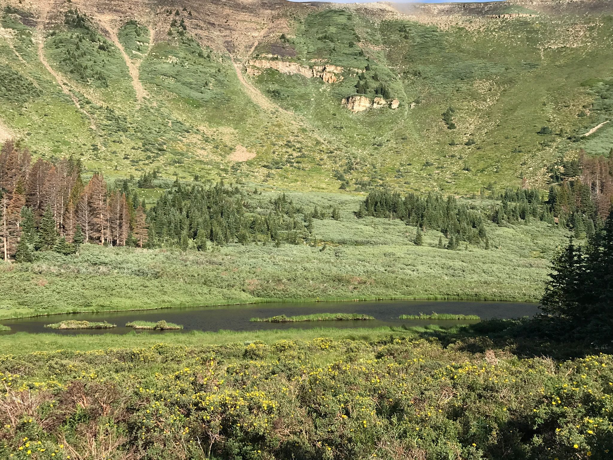
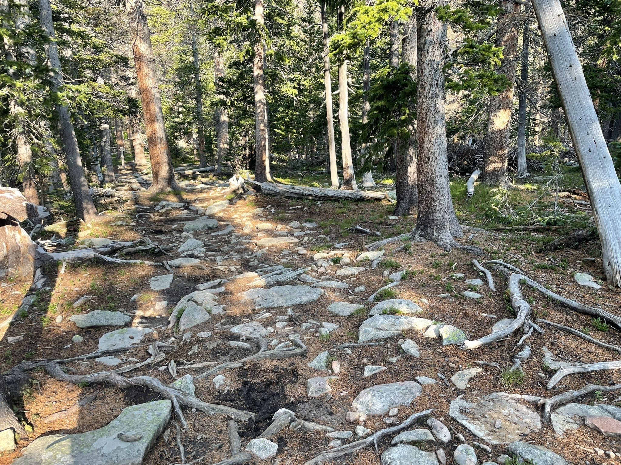
Jicarita Peak
NOTE: This very rocky trail is located in the 2022 CCHP Burn Scar, so there is no shade and may be damaged due to flooding.
Distance / Type: 10.9 Mile out and back
Trail rating: Moderate
Elevation Gain: 2,575’
Description: Located near Vadito, New Mexico, this trail is generally considered a moderately challenging route, and takes an average of 5 h 50 min to complete. It is known to feature amazing views of Truchas as well as Serpent Lake. This is a popular trail for birding, hiking, and walking, but you can still enjoy some solitude during quieter times of day. The best times to visit this trail are April through September.
Trail tips: Walking sticks may be useful. Bring a hat, sunscreen, lots of water, bear spray and other essentials.
Photo by A. Cannon – Taos, NM; AllTrails.com
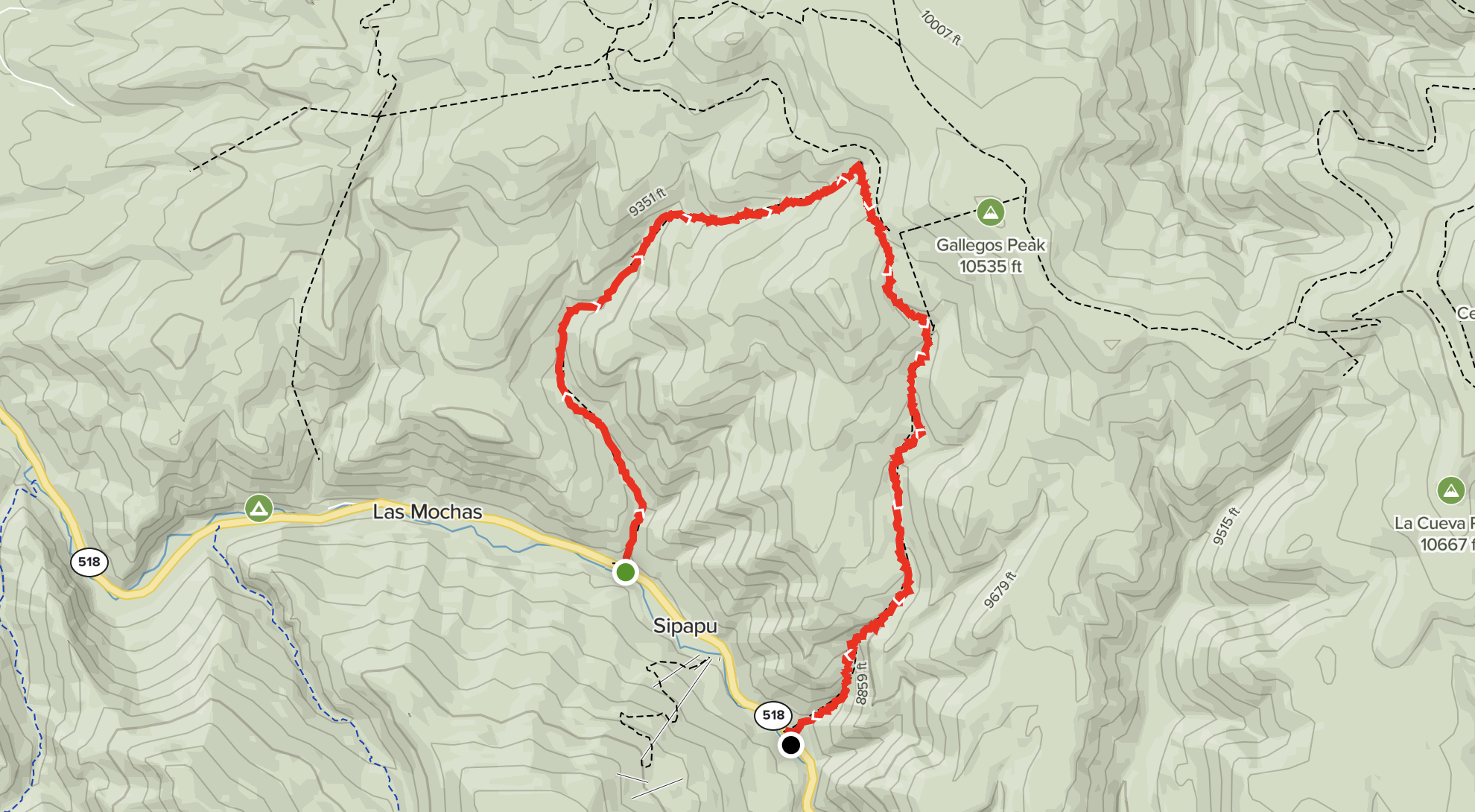
Gallegos Peak via Flechado Canyon
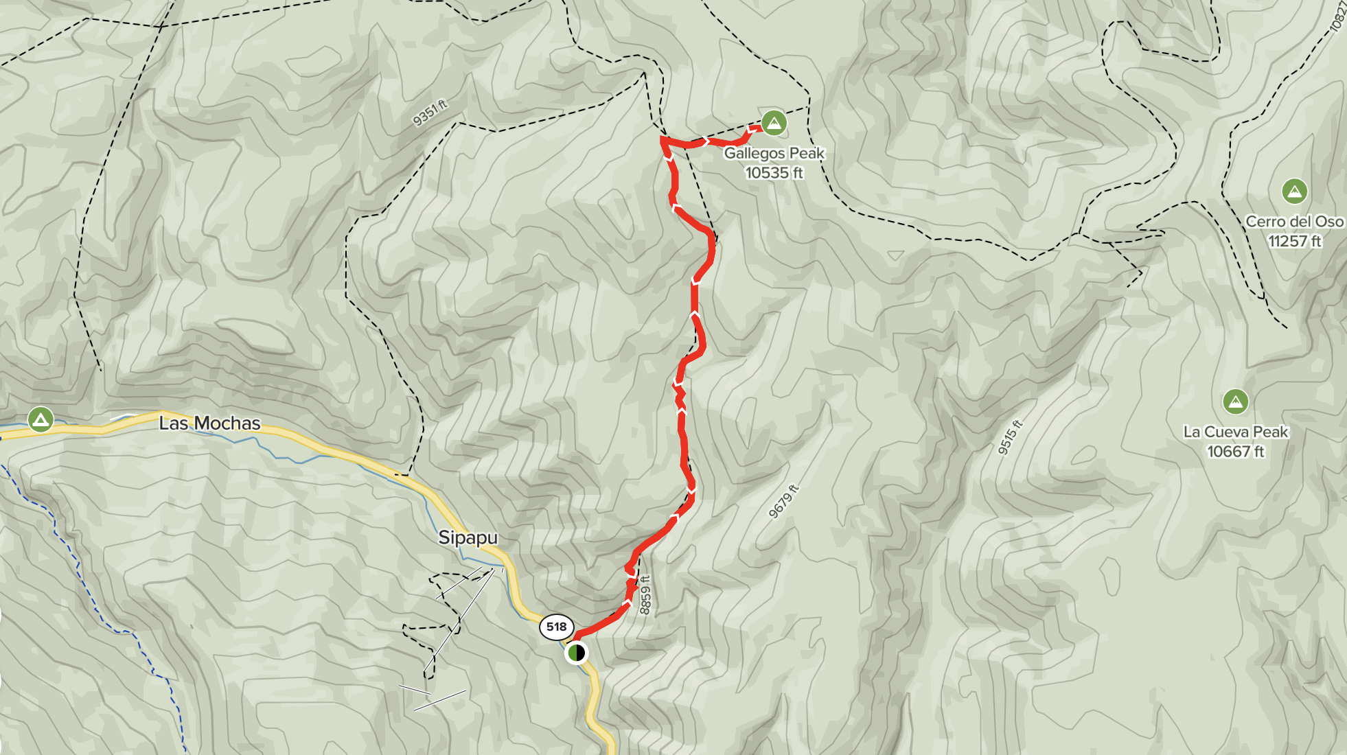
Distance / Type: 6.4 Mile out and back
Trail rating: Hard
Elevation Gain: 2,299’
Description: This out-and-back trail near Sipapu Ski Resort in Vaidito, New Mexico features waterfalls and scenic vistas with lots of fallen trees and steep and hard-to-find trails. Generally considered a challenging route, it takes an average of 4 h 16 min to complete. This trail is great for hiking, mountain biking, and running, and it’s unlikely you’ll encounter many other people while exploring. Dogs are welcome, but must be on a leash.
Trail tips: Walking sticks may be useful. Bring lots of water, bear spray and other essentials.
Photo by Kane S – Bethesda, MD; AllTrails.com
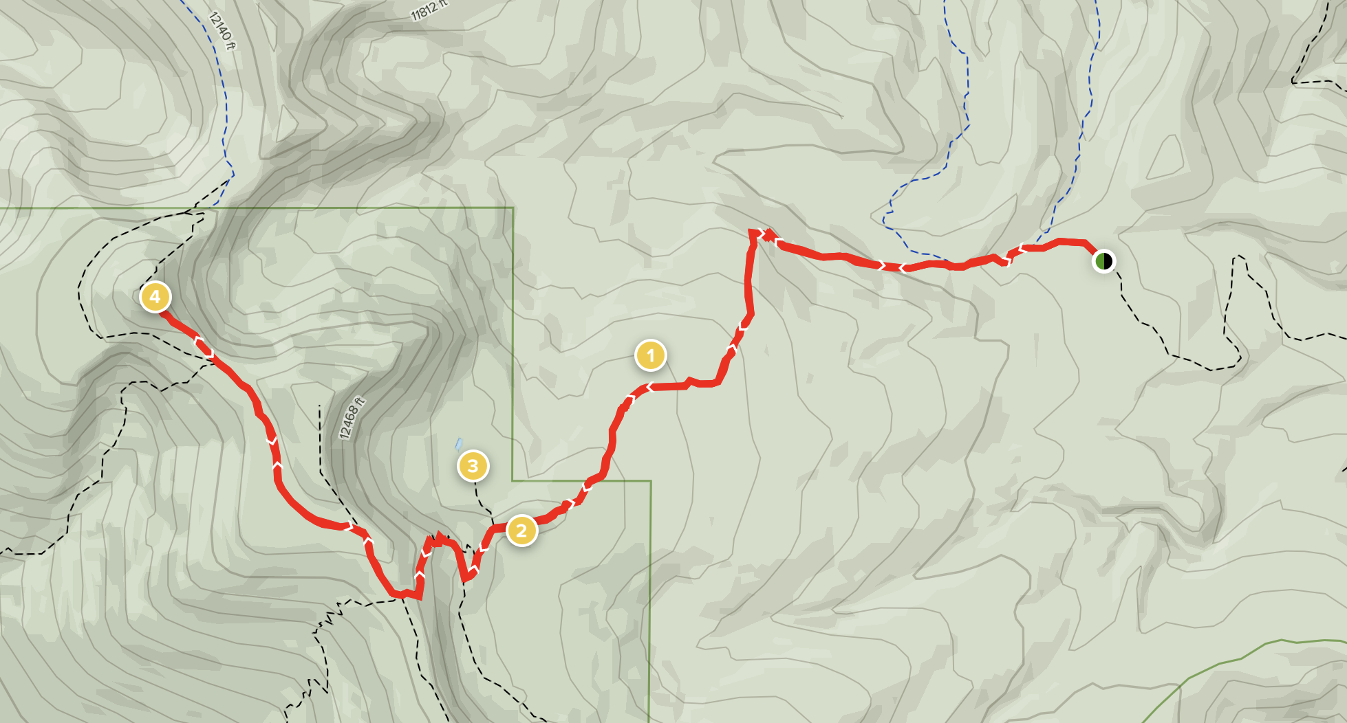
Gallegos Canyon to Flechado Canyon
Distance / Type: 8.5 Mile point-to-point
Trail rating: Moderate
Elevation Gain: 1,938’
Description: This point-to-point trail near Sipapu Ski Resort showcases the best of both Gallegos Canyon and Flechado Canyon. You can either leave a car at both trailheads to avoid walking on the road or complete this as a loop by walking along the road for about a mile. There are many beautiful viewpoints along the way and the trail travels along streams through aspen groves and open meadows. Generally considered a moderately challenging route, it takes an average of 4 h 25 min to complete. This trail is great for hiking, and it’s unlikely you’ll encounter many other people while exploring.
Trail tips: Walking sticks may be useful. Bring lots of water, bear spray and other essentials.
Photo by BJ Allen – Estes Park, CO; AllTrails.com
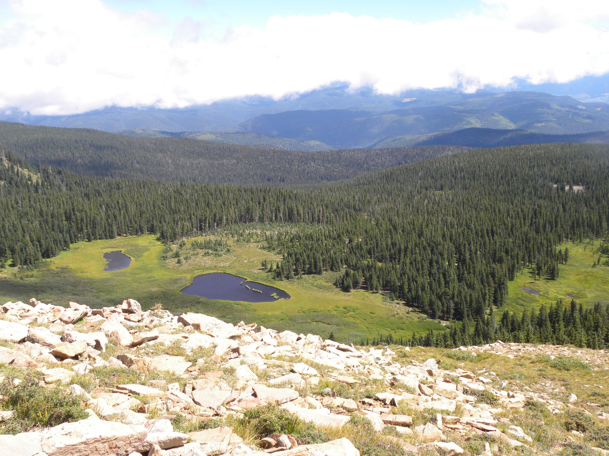
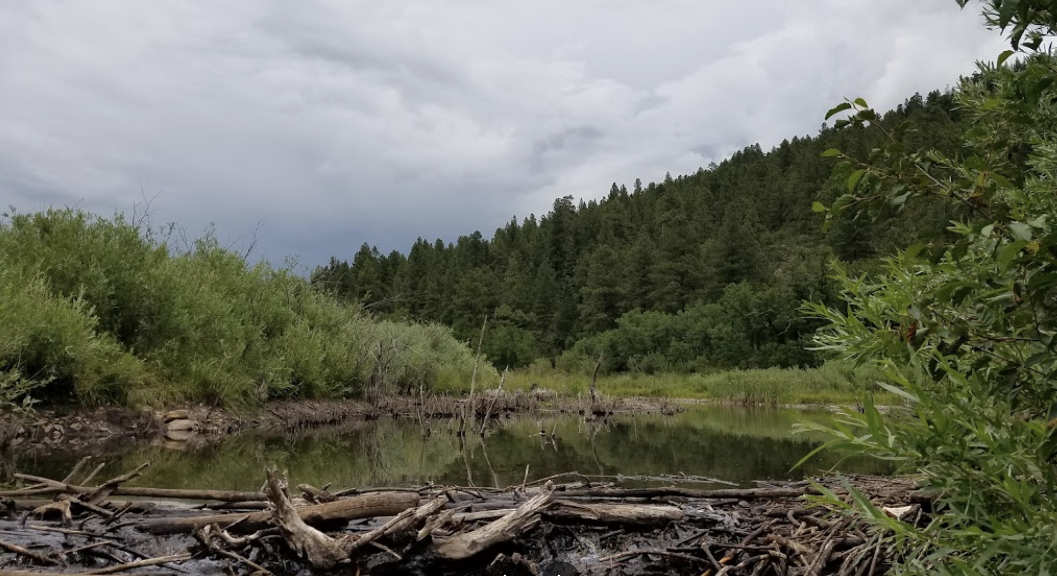
Horseshoe Lake
Distance / Type: 11.4 Mile loop
Trail rating: Moderate
Elevation Gain: 2,470’
Description: Explore this 11.4-mile loop trail near Vadito, New Mexico. Generally considered a moderately challenging route, it takes an average of 5 h 51 min to complete. This trail is great for hiking, and it’s unlikely you’ll encounter many other people while exploring.
Trail tips: Walking sticks may be useful. Bring lots of water, bear spray and other essentials.
Photo by Caleb Etheridge; Google Maps
Coyote Creek State Park
Eusebio Romero Trail
Distance / Type: .75 Mile point-to-point
Trail rating: Moderate
Elevation Gain: ~500’
Description: The 3/4 mile Eusebio Romero Trail takes you across the forested hillside above the creek. The trail climbs steeply up the hill behind the group shelter and returns to the creek near campsite 24 along a gentler grade.
Trail tips: Coyote Creek entrance fee is $5/pp. Walking sticks may be useful. Bring lots of water and other essentials. There is a geocache located on this trail.
COMING SOON:
- Mora Fish Hatchery Trail
- NEW! Rio Mora Wildlife Refuge – Sagebrush Trail